Archives

Ciao 2015!

Each year, I feel blessed by the life that I’ve been given. I’m healthy, and happy, and have the ability to spend much of my time doing the things I enjoy. I get to spend my days with my husband, friends and family. As I reflect back on 2015, I’m surprised at how quickly it has flown by, and what amazing things I’ve done! 2015 was certainly a year full of travel – so much that I had to expand my Top 10 list to 12!

In no particular order:

  1. We welcomed a new niece to the family in early February, and this little one is busy exploring the world and is just days away from walking!
  2. The El Niño phenomenon brought us a crazy-mild winter. We are talking temps in the 60s in February. Which was perfect for a Valentine’s Day getaway to the first-ever Bubbles Fest at Anne Amie Winery. Eleven Oregon sparkling wine producers, about 25 wines, oysters on the half shell, chocolate, and gorgeous “sitting on the patio” weather! I hope they do this festival again!
  3. Jon and I took a mini-getaway in late March back to Moab, Utah and Salt Lake City. We hiked Arches and Canyonlands National Parks, and we visited Antelope Island in the Great Salt Lake. And, I zip-lined for the first time and loved it!
  4. We knocked another National Park off our list by visiting Mount Rainier in April, on an unseasonably warm weekend. Temps were in the mid-60s! We snow-shoed for the first time, and did several great hikes, in addition to staying at the National Park Inn, our first “in park” accommodations!
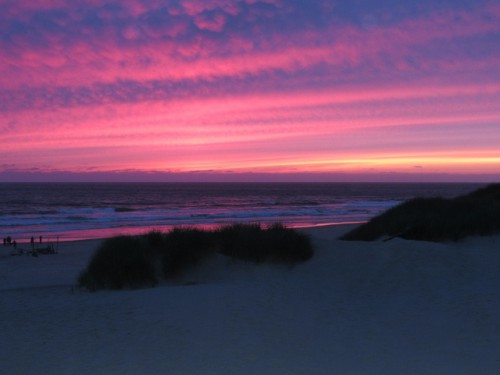
  5. We spent a fun long weekend with my family on the Oregon Coast. Jon and I also had a chance to visit a few of the area’s attractions – beer, wine, a lighthouse, and Lewis and Clark’s Winter Fort! The beach at Nehalem Bay State Park is also where I experienced the most beautiful sunset of the year!
  6. There were no major illnesses or injuries among our “herd” this year! Biz is 28, and rocking his mostly toothless smile, after having four more teeth removed in June. Oliver is doing well on his kidney food, and is healthy, other than a random couple of days of vomiting in early December. Oscar still loves getting love on his terms, and Coraline got even pudgier, despite a year on diet food. Time to crack down on portion sizes!
  7. After having such a nice long weekend with Jon’s parents last year, we decided to take a week-long trip to Colorado in August. I planned an epic road trip to see five National Parks and Monuments, and lots of other fun stuff! We had a great time!
  8. I completed my 7th half-marathon in September – the Woodinville Wine Country Half-Marathon. The cool temperature was wonderful, the course was fast, and I shaved 18 seconds off of my previous personal record – despite not having trained for it! Jon got second place in his age division too, and we enjoyed some nice wines and beer at the end!
  9. Our big trip this year took place in October – a trip that has been in the works for three years now! We had almost two weeks to tour Virginia (with a couple of stops in other states). We saw Shenandoah National Park, four Presidential homes, five Civil War battlefields and the place where Lee surrendered the Army of Northern Virginia. We also saw several other historic sites, and we finished off with a trip to Chincoteague Island to see the ponies made famous by Marguerite Henry and her children’s books. The memories will last a lifetime.  More posts on the trip are coming!
  10. I’ve been at my new job almost a year, and am enjoying the work (and the vacation accrual!) and making new friends. I miss seeing my old friends every day, but that’s just a reason to make sure we get together.
  11. Jon and I were feeling a bit sun deprived in December with all the rain here in the Northwest, so we booked a last minute weekend getaway to Joshua Tree National Park, in southern California. We hiked to our hearts content and added yet another park to the notches on our belts! The weather was dry the whole time, and it warmed up each day; it was the perfect sunny respite from our torrential downpours!
  12. And last but certainly not least, I celebrated two milestones this year. Jon and I celebrated our fifth wedding anniversary in June, and I turned 40 in September. I’m getting used to the 40 thing…
A stunning sunset at the Nehalem Bay Campground.

A Fabulous Sunset!

I know I have a tendency to gripe about the weather (and wouldn’t you if you had moss growing in your ears!), but in reality I know how lucky I am. I hope 2016 brings as much joy as 2015 did. And dear readers, I wish all of you all the best for the New Year!
Moab 2015: Castle Creek Winery

Upon leaving Canyonlands, we had a little bit of time before we had to make the long drive back to Salt Lake City. And it just so happens that a little way outside of Moab is one of Utah’s few wineries! I wanted to go!

Castle Creek Winery is located 14 miles up Highway 128, a scenic drive along the Colorado River. It also happened to be the route of most of Jon’s half-marathon the previous day, so I had the opportunity to see what he was up against. There was a long… uphill section that looked really tough! There are lots of campgrounds and trail heads along the highway that look like they would be perfect for exploring – if only we had more time.

The winery is on the grounds of a resort ranch. You can stay there, and it looked like activities included horseback riding, swimming, rafting, hiking, and of course, the winery. There is also a museum on the grounds that we didn’t have time to check out.

The sign seems more weathered than it should, given the age of the winery...  I sense a theme...

The sign seems more weathered than it should, given the age of the winery… I sense a theme…

Our tasting was interesting… A complimentary tasting included 5 samples, which let us taste all but one of the wines. They were decent but not complex, fine for everyday drinking but they wouldn’t hold up to age. None had much in the way of structure or tannins. But that isn’t what made it interesting. Our server did that all on her own. She was nice enough, but was an older lady who was very worn – I didn’t smell smoke but she had the look (and the voice) of a ‘several-pack-a-day-for-several-decades’ smoker.

I asked about the history of the winery, and her response was to urge us to go downstairs and watch the video. When we didn’t appear to be moving quickly enough, she kept prodding until we felt we had no choice but to go. Downstairs was odd. We found ourselves in a random cold, dimly lit hallway with glass windows facing out onto the dark production floor. And, as she promised, there was a 5 minute video explaining in extremely general terms the history of the winery and their production story.

Other than telling me that Castle Creek Winery played an integral part in changing Utah’s laws to allow for wineries, I learned nothing. Well, that’s not quite true… I had learned my lesson, and did not ask further questions upon emerging from the “dungeon.” That made the tasting go really quickly. That said, the wines were fine, and several had beautiful labels, so I bought one bottle to enjoy in our hotel room that evening and we got on our way…

Picturesque truck

Picturesque truck

And because the winery didn’t inspire me to take any photos inside, here’s a photo of what I hope is an authentic historic school outside of Moab.  I say I hope because it shares its parking lot with a gas station.

A historic schoolhouse - I hope...

A historic schoolhouse – I hope…

We made the long drive back to Salt Lake City in order to fly out the next morning. Another great vacation had come to a pre-mature end…

Moab 2015: Neck Spring Trail

The day after Jon’s half marathon we decided to do a more challenging hike. I had researched the options at Canyonlands National Park and decided on the Neck Spring Trail – a 5.8 mile hike into the canyon that leads you by several features from Canyonlands’ ranching history. It is hard to believe that Canyonlands, with its dry scrub brush, would support much life, but both cattle and sheep ranching were prevalent here, beginning in the 1880s and going all the way up through the 1960s.

We arrived at the trail head about 10:15 am, got our gear prepped – lots of decisions… How much food and water do I need to bring, am I starting out with a fleece or without, hat on or off, get the camera ready. It’s an ordeal, I tell you! The hike starts at the top of the mesa, but quickly begins dropping into the Neck Spring Canyon. The total elevation drop is about 300 feet.

Jon hiking ahead, as usual.

Jon hiking ahead, as usual.

Shortly after we started the hike, we came upon an old watering trough from the early 19th century. Near the trough, we were also lucky to see, and get a picture of, a pinyon jay! At this point we were very close to the first spring; imagine water in the desert! There was quite a bit of shade there, due to several cottonwoods growing near the spring.

We saw a Pinyon Jay!

We saw a Pinyon Jay!

A watering trough on the Neck Spring Trail

A watering trough on the Neck Spring Trail


Leaving the spring, we hiked through loose sand up to the top of the butte. We ate our picnic lunch along a spur trail that goes right to the edge of the mesa and overlooks Taylor Canyon in the distance. What an awesome view! Shortly after lunch, we came upon another spring, and evidence of an old cabin and 100 year old barbed wire. That stuff sticks around forever… Longer than Twinkies! The cabin let us know that we had moved into Cabin Spring Canyon.

A dead tree makes a unique focal point.

A dead tree makes a unique focal point.

An unusually shaped dome off the Neck Spring Trail.

An unusually shaped dome off the Neck Spring Trail.

Eventually, the trail heads up a slick rock section where we had to scramble to get back to the top of the mesa. The trail has been rerouted, and this is definitely the most challenging part of the trail. What a scramble – I was sweaty and breathing heavy after this part. It wasn’t that far though.

Jon and I after scrambling up the slick rock on the Neck Spring Trail. Another watering trough behind us.

Jon and I after scrambling up the slick rock on the Neck Spring Trail. Another watering trough behind us.

Once at the top, Jon thought that we were almost done. However, at the top of the mesa we found another cattle watering trough before we began meandering through loose sand along the mesa top with views of Cabin Spring Canyon and Neck Spring Canyon below. We saw parts of the trail we were hiking on below too! We saw gorgeous views of Taylor Canyon in the distance. Other notable finds were old tin cans, and cougar poop. Scat for those of you who are really into poop. We did not see the cougar that went with the poop though.

The view looking out of Schafer Canyon from the end of the Neck Spring Trail

The view looking out of Schafer Canyon from the end of the Neck Spring Trail

After another mile or so along the mesa top, we got back to the trail head, coming from the opposite direction along the road. The section of the hike gave us some really great views of Schafer Canyon and the Schafer Rim Trail, where several Jeeps were making their way down to the canyon floor. It was so neat to watch!

A Jeep headed down the Schafer Rim Trail into Schafer Canyon

A Jeep headed down the Schafer Rim Trail into Schafer Canyon

To wrap up a fantastic hike, after we got back to the trail head, a beautiful raven also posed for me along a picturesque fence.

A raven keeping watch at the Neck Spring Trail Head.

A raven keeping watch at the Neck Spring Trail Head.

I could have stayed in Canyonlands forever…


Moab 2015: The Windows and Double Arch

After Delicate Arch, which are the most famous arches at Arches National Park?  The Windows!  And we had a chance to visit them!

The view of North Window from afar.

The view of North Window from afar.

After Broken Arch and Sand Dune Arch we decided to visit the arch trifecta in the park, the Windows section. Windows gives tourists a big bang for their buck, with four arches all visible from the parking area, or from close up if you walk a mere mile round trip from the parking lot. We started our hike on pavement, up some stairs to North Window. North Window is even with ground level here, so there was no shortage of people climbing around in it. That’s the drawback of the accessible arches.  There were lots of screaming children here too, so we took a few photos and headed on our way.

North Window Close Up

North Window Close Up

South Window is just past North Window, and is actually carved from the same sandstone fin. South Window is above the ground though, so I like the views here better because I could get a photo without the throngs of people that are standing and sitting in North Window.

South Window

South Window

South Window Close Up

South Window Close Up

Turret Arch is nearby – I think it looks like a keyhole – and there is a little unnamed arch right next to it. With a little bit of effort you can climb up into it, so I had Jon take my picture standing in the arch. Despite saying that he regretted not standing in Delicate Arch for a photo, he wouldn’t go up and stand in Turret Arch. Some things never change.

Turret Arch

Turret Arch

Somehow, I convinced Jon to go on the primitive trail back to the parking lot. I just had to explain there wouldn’t be people on it. And I wasn’t kidding – we walked around behind South Window and all the crowds vanished within 100 feet. We were all alone! I liked the photos from this angle best, as I was able to capture the sinking sun framed in North Window, and the people standing in it were small enough to not be obtrusive.

The sun setting through the South Window arch.

The sun setting through the South Window arch.

The primitive trail wasn’t anything too challenging, and a short hike saw us back in the parking lot. We had one more arch that I wanted to see, but I could tell that Jon’s energy was fading. He was a sport though, and let me do the trek down to Double Arch, which is off the same parking lot as the Windows.

Flowers near North Window

Flowers near North Window

Double Arch is two arches that are joined at one end, giving a very unique look when photographed from below. The hike is 0.5 miles roundtrip through some soft sand. Once we were there, I climbed up on the slick rock to get some better photos while Jon waited below. There were several young adults climbing under the arch, but I was able to get some photos with only a couple of people in them. All in all, I thought this arch was much more peaceful than the Windows.

Double Arch

Double Arch

We didn’t linger long because Jon was getting really tired and we were both hungry. We headed back into town and decided to go to Zak’s for dinner. Zak’s has steak and other eats, and we were able to get a table in the bar after only about 5 minutes (the wait in the restaurant was about 35 minutes, they said). The full menu is available in the bar, and it was a non-smoking place, so that was just fine with us!

The service was prompt and friendly – and we ordered beers – the Moab Brewery Dead Horse Ale for me, and the Squatter’s Brewery Hop Rising for Jon. We both ordered the Flat Iron Steak with asparagus, with rice for Jon and a baked potato for me. That really hit the spot! We were so hungry that I completely forgot to take any photos of our meal. Jon polished his off with a Uintas Brewery Hop Notch, and I drove us home for an early night…

What a fabulous, action packed day we had!

Moab 2015: Broken Arch and Sand Dune Arch

In my last post, Jon rocked his half marathon, we had a fabulous lunch in downtown Moab – but we were far from done for the day!

After lunch, we were eager to get out touristing, but obviously Jon wasn’t going to be up for a lot of hiking. I drove – and we headed to Arches. Since we were later coming into the park – it was about 1:30 pm – we found ourselves in a HUGE line at the park entrance… We waited a long time – probably about 45 minutes to get into the park. Fortunately for me, Jon was exhausted… too tired to complain about the wait. I did spend some time thinking it would be nice if they had a priority line for National Parks Passholders!

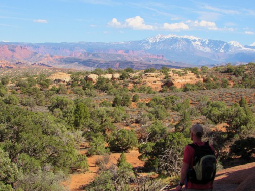
Eventually we made our way into the park, where I had picked out some easy hikes to some of the Arches we hadn’t seen yet (the ranger had given me some great ideas when I was at the Visitor’s Center that morning). We started at Broken Arch – named for the fact that there is a large vertical crack right in the middle of the arch. Broken Arch is 0.6 miles (1.2 miles round trip) of flat hiking through slightly soft sand, with views of the La Sal Mountains in the distance. Remarkably, when we got to Broken Arch, there was just one other family there, and they headed out shortly after we arrived. We were all alone, only 0.6 miles from the trail head!

The view from the Broken Arch trail head

The view from the Broken Arch trail head

Jon and me on our way to Broken Arch - Jon is rockin' his half-marathon shirt

Jon and me on our way to Broken Arch – Jon is rockin’ his half-marathon shirt

Broken Arch is one of the arches you can climb under, so I tried my luck at getting the proverbial “jumping photo.” Our timing wasn’t great though, because several attempts all caught me barely above the ground – you’ll just have to take my word for it that I’m able to jump super-high, while looking completely put together – HA! Sigh… We loved the quiet at Broken Arch, and sat on the rocks near the arch for a while, just enjoying the view and the solitude. But not for too long, because Jon didn’t want his muscles to stiffen up.

Broken Arch!

Broken Arch!

Me jumping at Broken Arch - I jumped really high - seriously...

Me jumping at Broken Arch – I jumped really high – seriously…

As we were getting ready to go, we ran into a young lady from Colorado trying for a selfie with the arch, so I offered to take her picture. We got to talking and she offered an interesting story. She had accompanied a friend who came to Moab to go on a group back-country uni-cycling tour. She came along to do some hiking while her friend was uni-cycling. I had no idea there were organized uni-cycling tours and back country no less!

Jon looking at the view of the LaSal Mountains from Broken Arch

Jon looking at the view of the LaSal Mountains from Broken Arch

This rock reminded me of a poodle - what do you see?

This rock reminded me of a poodle – what do you see?

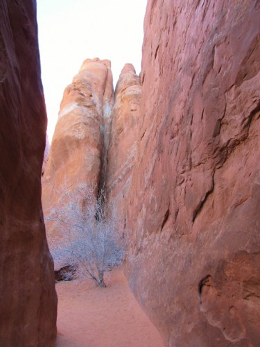
On the way back from Broken Arch we took the short spur trail off to Sand Dune Arch. Sand Dune Arch is between two sandstone fins, and loose sand collects there making a fun experience for kids, who can play to their heart’s content in the red sand. And not so fun for this childless couple and my delicate ears – the sounds of kids yelling and shrieking echo loudly here!

A dead tree between the fins at Sand Dune Arch

A dead tree between the fins at Sand Dune Arch

Sand Dune Arch - which one of these kiddos won't make it?

Sand Dune Arch – which one of these kiddos won’t make it?

We hung out long enough to get some photos of Sand Dune Arch, with kids posing, jumping and back-flipping underneath. All only feet from the posted sign that says that Sand Dune Arch has experienced recent rock fall and you shouldn’t stand underneath. Either all those parents are illiterate, clueless, or hoping that the rock fall comes and takes out one of their brood – you decide!

People are stoo-pid...

People are stoo-pid…


Moab 2015: A Red Rock Half Marathon

Finally, Jon’s day had arrived – the Canyonlands Half Marathon! He had been looking forward to running a half marathon among the beautiful red rocks. The race is a point to point, beginning about 10 miles up Highway 128, along the Colorado River.

I dropped him off at 7:15 am to take one of the busses up to the start of the race. They close Highway 128 for the race, so there is no way for race participants to get a ride there except for via the busses. We said our goodbyes and I wished him luck, and went back to the hotel for breakfast.  I have my priorities.

Since there is not really anyplace where spectators can view the majority of the race due to the Highway 128 closure, this is really my story… I spent a leisurely morning, heading out to Arches National Park to see the exhibits in the Visitor’s Center.

Jon doesn’t always like to watch the movies that they have, so this time I sat down by myself in the theater and watched the whole thing. The Arches movie focuses on the geology of the park and the forces of nature that have created its arches over the last several million years. It also shows the process of erosion, and explains how arches are just a temporary feature, lasting only until erosion breaks them down.

Sedimentary Rock Types in Arches National Park - Arches NP Visitor's Center

Sedimentary Rock Types in Arches National Park – Arches NP Visitor’s Center

After the Visitor’s Center, I headed back into town, where I passed several of the 5 mile runners, and went to the rock shop just outside of town. This rock shop had everything. You could find all kinds of fossils, rocks, petrified wood and shell imaginable. I spent a while in there, just looking at everything. There was a gorgeous, huge fossilized dinosaur nest, with several intact eggs (not for sale), as well as a carved, stone skull that was beautiful.

For kids (or the young at heart) they distribute cards that entitle the holder to a free piece of dinosaur bone. To collect, you have to follow the dinosaur prints around the store to the shelf where you can choose your piece. I don’t doubt they are pieces of dinosaur bone, but I learned you have to know what you are looking for. There is no way that I would have guessed what I was holding wasn’t just another rock.

Soon enough, it was time to head into downtown and find a parking spot to go see the end of the race. I had enough time to watch and cheer for the runners for about 20 minutes before Jon came in with a time of 1:36:36. I was so pleased with him, especially since the race is at an elevation of over 4,000 feet, and we aren’t used to high altitude! He said it was the most difficult half marathon he has done, and he could totally feel the elevation.

Jon's Half Marathon Finish - 1 hour, 36 minutes, 36 seconds

Jon’s Half Marathon Finish – 1 hour, 36 minutes, 36 seconds

We got him hydrated and then headed back to the hotel so he could take a shower. And then we were off to get lunch! We decided to go to the Twisted Sistas’ Café, a place I had seen reviews for on TripAdvisor. We got there just before it started filling up, and ordered. I ordered the Jamon Serrano Wrapped Shrimp Salad, with chopped romaine tossed with tomato, Kalamata olives and parmesan in a creamy lemon dill dressing, topped with baked shrimp wrapped in jamon serrano.

The most amazing salad!

The most amazing salad!

Jon had the Grilled Turkey and Smoked Cheddar Wrap – Grilled roasted turkey breast, bacon and melted smoked cheddar on a warmed garlic-herb tortilla wrap with lettuce, tomato, onion and avocado, drizzled with a smoked paprika aioli.

Both meals were fantastic, but my salad knocked my socks off! The tangy dressing with the salty jamon serrano wrapped around big shrimp. It was so delicious – I will certainly go back again for that meal!

Moab 2015: Two Hikes at Canyonlands

In my last post, I conquered my fear of zip-lining, but we were only half-way through the day! I had more hiking adventures planned for us in the afternoon!

After zip-lining, the day was heating up, so we changed into shorts and were on our way. We grabbed what we thought would be a quick lunch before getting out to hike at Canyonlands National Park. Best laid plans…

We went to the Peace Tree Café again, which we had visited when we were in Moab the year before. We got an outdoor table, our waiter took our order quickly, our food arrived quickly, and it was great. Jon had a Cobb salad and a beet/carrot/celery juiced drink, and I had a burger with Pepper Jack cheese and a Diet Coke.

But that’s where the trouble began, because our waiter did a “vanishing act”. We kept seeing him heading to other tables nearby but would never even look our direction. After trying to get his attention for at least 10 minutes, I went to the hostess podium to get our check. What great service at the beginning only to flop at the end…

But soon enough, we were headed to Canyonlands. I had two hikes I wanted to do – I researched hikes that were easy, because Jon didn’t want anything strenuous the day before his half-marathon. The first was the Aztec Butte Trail.

The view of the mesa from the Aztec Butte Trail

The view of the mesa from the Aztec Butte Trail

You begin hiking through the soft sand of the mesa top, with scrub brush and early spring flowers all around. One spur of this trail takes you around a butte, and then there is a short hike up slick rock to get onto the Butte. Once on the butte, you can climb down to an overhang where there are two granaries beneath the overhang, built by Puebloan people who lived in Canyonlands Park. They are very simple – nothing like the cliff dwellings you see at Mesa Verde or Bandelier, but neat nonetheless.

A Puebloan Granary on the Aztec Butte Trail

A Puebloan Granary on the Aztec Butte Trail

The main trail of the Aztec Butte Trail heads up a different slick rock hill – a fairly short steep trail up another butte. This trail features a couple more Puebloan ruins, and spectacular views of the mesa top. We only went a little way up this trail so we didn’t overdo it – but we liked what we saw.

The view from the Aztec Butte Trail

The view from the Aztec Butte Trail

Our second hike that day was a 2 mile round trip out and back hike along the rim of the canyon, called the Grand View Point Trail. The trail is very easy hiking, with mostly flat terrain and some steps cut into the stone at certain points. We hiked along the mesa edge (not too close though) with views overlooking Monument Basin – to me it looked like really, huge, chubby fingers. There are several tall spires jutting up from the valley floor in this area – the tallest one is called the Totem Pole and is 305 feet tall.

The "chubby fingers" of Monument Basin

The “chubby fingers” of Monument Basin

The view into Monument Basin on the Grand View Point Trail

The view into Monument Basin on the Grand View Point Trail

Blooming wildflowers at Canyonlands

Blooming wildflowers at Canyonlands

The trail ends at Grand View Point and provides some really fabulous views of the Canyon below, as well as Junction Butte to the south. Grand View Point is the southernmost tip of the Island in the Sky District of Canyonlands National Park, and from it you can see the Needles District to the south, and the rarely visited Maze District to the West.

The view from Grand View Point.

The view from Grand View Point.

The rock formations at Grand View Point

The rock formations at Grand View Point

The hike also offers some great views of the Schafer Rim Trail, a 100 mile back country road for off-road vehicles. You can easily see the old mining roads that cut across the bottom of the canyon, built when Canyonlands was mined for uranium in the 1950s.

I think this is a Side Blotched Lizard.

I think this is a Side Blotched Lizard.

The Grand View Point Trail is a nice easy hike for people of all abilities and would be good for kids, as long as they are old enough to follow instructions and not venture too close to the edge of the canyon.

What a spectacular day we had enjoying our National Parks!

Moab 2015: Facing My Fears in the Sky

Have you ever stared death in the face? I have! Ok, so perhaps I’m exaggerating a bit, but Friday morning was our zip-lining adventure! I had been alternating between looking forward to it, and absolutely dreading what was sure to be my impending death.

Jon had seen the zip-lining shop when we had been in Moab the year before, and really wanted to try it. I said I would, even though, as you may remember from some of my previous posts, I have a very healthy fear of heights. But I like to challenge myself, so I purchased two non-refundable tickets to a 6 zip-line adventure, complete with an off-road UTV (Utility Terrain Vehicle) ride up to the zip-lines, and a trek across a suspension bridge. Of course, I hate wasting money, so I knew if I made the purchase, I was not likely to chicken out.

As we were getting ready, I started getting really nervous. Jon told to try not to think about it – maybe listen to my audiobook? My nerves abated as we walked across the street to the shop, but I got nervous again when signing the waiver. I went and sat outside to wait for the safety chat and ponder my impending death. Shortly the other soon to be dead tourists all assembled outside and our guides – Chris and Jake – showed us how to get into our harnesses and helmets. I snugged my harness up as much as I could, knowing that I was still a goner.

Soon we bundled into two UTVs and headed up the mountain. The trip was exciting and scary at the same time! Chris explained that in the world of off-roading, this road would be considered a 4 on a difficulty scale of 1-10. It seemed like a 9+ to me.

Heading up to the Zip Lines

Heading up to the Zip Lines

He explained how the zip-line company came to be, and the fact that it is located on private land. He also explained how the zip-lines were engineered and their safety features. I started to feel a little more comfortable, because lots of the reviews said the trip up to the zip-lines was scarier than the zip-lines themselves. I might actually live!

We reached the top of the hill and climbed up a short, steep section of the slick rock to the beginning of the first zip-line. It was called Sneak Peek and it was 280 feet long, designed to ease you in to zip-lining. My nerves were back. I made Jon take a photo with my cellphone to document my last moments on earth. I look nervous…

Me before my first zip - how green do I look?

Me before my first zip – how green do I look?

Jake (one of our fearless guides) zipped first so he could operate the braking system for the rest of us. I was relieved that I didn’t have to try to stop myself… Chris asked who wanted to go first and a 12 year old kid volunteered (I am not an early adopter…). He looked like he was having fun! I volunteered to go third, afraid that if I waited too long I would lose my nerve. But I did it! I screamed a little bit after I first stepped off, but I did it! Once Jake had stopped me at the other end, he had to remind me to let go of the handle… But I did it! And it was fun!

The zip-lines get a little longer and faster from the first one – they are all named for their successive features and challenges. The longest zip- Home Run – is 1300 feet long. Each is unique, some are steeper, some are windier (so you spin more), but they were all fun.

Jon has fantastic form

Jon has fantastic form

Jon waiting for his next zip

Jon waiting for his next zip

In between zip-lines, there are short hikes, including one with a suspension bridge (which looked totally safe but was still scary for me!), and amazing views.  We got a bird’s eye view of Moab, and could even see several of the rock formations in Arches National Park – 10-15 miles away.

We Made it over the Suspension Bridge!

We Made it over the Suspension Bridge!

Don't we look cute!?

Don’t we look cute!?

The course is near other UTV routes, so we saw some of the off-road tours go by, and the last zip-line goes right over a mountain bike route, so we got to fly over top of several mountain bikers pushing their bikes up a steep section of slick rock.

Jon zipping the last zip - Home Run.

Jon zipping the last zip – Home Run.

I took video with my camera – I don’t have a GoPro, so I just hung it around my neck and pressed record, hoping the camera wouldn’t flop around too much or turn around on my body…. I think it worked pretty well.  The video below is me on the last zip-line – Home Run (bear with the slow start…).

I didn’t want it to end. I was ready to keep going all day long! But soon we had reached the end of the sixth zip-line, and Chris and Jake went to go fetch the UTVs so they could drive us back down the hill. Which again, was a trip that was scarier than the actual zip-lining.

The UTV Ride down the hill - it was pretty steep!

The UTV Ride down the hill – it was pretty steep!

I was very proud of myself for doing it and not chickening out. It was exhilarating being able to conquer my fear of heights and discover that something I was terrified to do is actually really fun! Chris and Jake were great – very supportive and it is clear that they get a kick out of helping someone get over their fear as well. I loved this adventure!

Have you ever zip-lined?  If you are interested in trying it out in Moab, Utah, I can’t speak highly enough of Raven’s Rim Zip-Lining – they were great!  http://www.ravensrim.com/

Moab 2015: We Made It!

It was time!  To make our way to Moab that is!  We couldn’t wait to get back there after so thoroughly enjoying our time there last year.

We stopped south of Salt Lake City for a quick lunch and some snacks, and then got on the road for the trip down US Highway 6. Highway 6 is the main highway between Salt Lake City and Moab, and used to be a main thoroughfare between the Midwest and California, until it was bypassed by I-70. It is a very winding highway that is often only one lane in each direction, with passing lanes at regular intervals.

It winds through the city of Price, Utah, a mining town that might be fun to pass a day in. Price has a mining museum and some dinosaur attractions, commemorating the fact that many dinosaur fossils have been found throughout the area. That said, Price seems like a town that time forgot, at least the sections visible from the highway. Lots of run down homes and empty buildings.

Further south from Price, Highway 6 also passes by the Cleveland-Lloyd Dinosaur Quarry, which is still being quarried for fossils today (that would be cool to visit). I hadn’t heard of it before, so did a little research on it later.

It was an uneventful drive – we did end up seeing 3 pronghorn and 3 prairie dogs (no photos as we blazed by at 65 mph)… one day I will get a good photo of pronghorn in the wild.

We ended up in Moab right about 4 pm, got checked into our hotel room and immediately changed into hiking clothes. We were at Arches National Park at 4:20! We stopped at the first trail head in the park, the Park Avenue hike – an easy 2 mile out and back through a wash beneath gorgeous sandstone formations.

Jon taking in Park Avenue.

Jon taking in Park Avenue.

The Park Service has Park Avenue listed as a moderate hike, but that is really only because it has a set of stone stairs at the beginning of the hike. If you started the hike from the second trail head, you could do almost the whole hike without the stairs. Much of the hike is in shade, which made it relatively cool (I was wearing shorts and had to put on a fleece).

Sheep Rock, from our Park Avenue hike.

Sheep Rock, from our Park Avenue hike.

After our Park Avenue hike, we drove down to the Balanced Rock viewpoint. Balanced Rock is one of the most recognized features in the park, and it is an easy walk on a paved sidewalk (total round-trip distance 0.3 miles).

I can't get enough of this view!

I can’t get enough of this view!

I asked Jon to try to take a picture of me “holding up” Balanced Rock, like they do with the Leaning Tower of Pisa, but he was not up to the challenge. He took the camera, looked at the viewfinder for a second, snapped a pic, and said “here, that’s as good as it’s going to get.” This was the result…

Me

Me “holding up” Balanced Rock. Ignore my totally pasty, white legs – I’m from the Northwest…

This is what I need girlfriends for – they are way more accommodating to my foolishness…

Balanced Rock at Arches National Park

Balanced Rock at Arches National Park

Balanced Rock was great, but it was dinnertime, and we wanted to make sure to get a place at the Moab Brewery, so we headed back into town. The brewery wasn’t nearly as packed as it was last time for some reason, so we were able to snag a table right away in the bar.

Jon ordered the Black Imperial IPA that he had last time we were there, and our server told him that the latest batch was hit or miss, due to some weird, unknown problem during bottling. He said that Jon was welcome to try one and give it back if it wasn’t good.

We appreciated his honesty and the commitment to a quality product, so Jon ordered a Hopped Rye beer instead and a veggie burrito. He loved both. I had the Dead Horse Amber, which was sold out last time we were there, with a Reuben sandwich, both delicious. We enjoyed our beers, and both had seconds, with Jon ordering another Hopped Rye and me getting a Hefeweizen.

Jon's Veggie Burrito

Jon’s Veggie Burrito

After the brewery, we headed back to the hotel for a relaxing evening.  We had a full day of adventuring coming up, including zip lining!

Moab 2015: 3 Mormons and a Catholic. Buildings!

If you had a morning to do some sightseeing in downtown Salt Lake City, where would you go?

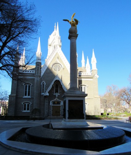
We began our day at Temple Square to see the Salt Lake Temple, arguably the most famous Mormon Temple in the world. Non-Mormons are not allowed inside, but you can tour the grounds and check out some of the other buildings. We strolled around for a short while to get some photos of the Temple, the Assembly Hall and the Mormon Tabernacle Choir building. The choir practices in the afternoon, but we didn’t want to hang around that long.

The Assembly Hall at Temple Square - Built 1880 - Gothic Revival Architectural Style

The Assembly Hall at Temple Square – Built 1880 – Gothic Revival Architectural Style

A Burst of Color Early in the Season

A Burst of Color Early in the Season

The Salt Lake Temple took over 40 years to build – it was started in 1853 and was completed in 1893.  It was designed by Truman O. Angell, one of Brigham Young’s brother-in-laws, who was also the architect for the Lion House and the Beehive House.  Construction originally began with sandstone, but had to be halted during the Utah War – the foundation blocks were buried to avoid being a target during the conflict.  If you haven’t heard of the Utah War, it is the conflict between the Mormons and the U.S. Military that led to the massacre of 120 California bound settlers by the Mormons that is known as the Mountain Meadows Massacre.  But I don’t want to get into that here.

When they resumed building after the Utah War, they discovered that the sandstone had cracked, so they replaced much of the sandstone with gray quartz monzonite and built with it going forward.  The stone has the look of granite.  The temple is 222 feet tall and has several ornate pinnacles.  The temple is absolutely stunning and so large that it is next to impossible to get it all in one photo.

The Salt Lake Temple - Built 1853-1893

The Salt Lake Temple – Built 1853-1893

A statue commemorating the fact that many Mormon Pioneers made the journey on foot with their only belongings in a hand cart.

A statue commemorating the fact that many Mormon Pioneers made the journey on foot with their only belongings in a hand cart.

After the temple, we walked two blocks down the street, past the Mormon Church Administrative Offices, and saw the Lion House and the Beehive House.  They are next door to one another and were built by the Mormons for Brigham Young. The Lion House was built in 1856, and has 20 bedrooms.  It was named for the large statuary lion that sits above the door, although some say the lion is there because Brigham Young’s nickname was the lion.

The Lion House - Built 1856

The Lion House – Built 1856

The Lion House housed several of Brigham Young’s 55 wives and 57 children, in a long three story building with 20 bedroom suites along long main hallways on the second and third floors. The basement houses a dining room that is open to the public today. It serves comfort food, but no alcohol or caffeine, in keeping with Mormon customs. Only the dining room is open to the public, but the Mormon church rents the Lion House out for events, so you can sneak a peak at the interior on their website.

The detail of the lion on the Lion House

The detail of the lion on the Lion House

Next door is the Beehive House, which was Brigham Young’s office, as well as being the residence for one of Brigham Young’s most senior wives and her nine children. It was built between 1853 and 1856.  A brief 20 minute tour is available for free, provided by Mormon missionaries, called Sisters, who serve as docents for the tour. I warned Jon ahead of time that the docents are known to proselytize, and after originally saying he wanted to wait outside, Jon grudgingly agreed to do the tour with me.  “You can put up with it for 20 minutes,” I said, “For me.”  What a guy!

The Beehive House - Built 1853-1856 - Greek Revival Architectural Style

The Beehive House – Built 1853-1856 – Greek Revival Architectural Style

Our docents were from Arizona and Italy. They let you know at the beginning of the tour that they will be sharing information about their faith, but didn’t give the hard sell to anyone on our tour (there were six of us). We wandered around the rooms, stopping briefly in each one, admiring the furniture and hearing some brief information about the Mormon belief system.

The beehive detail on the top of the Beehive House

The beehive detail on the top of the Beehive House

Our docents did not know much beyond the script of their faith. They didn’t know who designed or built the Beehive House, whether any of the furniture was original, or even how many wives or children Brigham Young had (although I do suspect they might be instructed to tell tourists they don’t know the answer to the wives/children question, in order to distance the Mormon church from its controversial polygamist history).

The interior of the Beehive House

The interior of the Beehive House

All in all, it was a historic home tour unlike any other I’ve experienced. The home was really just the backdrop for the explanation of their faith, rather than the star of the show.

I would have preferred if they would have explained why they built the home with a beehive on the top, or beehive accents in the home (the newel posts are carved beehives).  The beehive has been a religious symbol of industriousness since Roman times, and the word Deseret, used by the Mormons to describe their proposed territory during the 1800s, means honeybee.

It also would have been nice if the sisters explained anything about the business that Brigham Young conducted from the home, or when it ceased to be a home and office and became a “museum.” But, based on the reviews I had read, I really didn’t expect much history from the tour, so it is hard to be very disappointed.  To be clear, all of the historical information in this post was gleaned from the internet.

Our last stop of the morning was a couple of blocks down the street, at the Cathedral of the Madeleine, Salt Lake City’s Catholic Cathedral. It is stunning, constructed in the Neo-Romanesque style in 1909, with the most exquisite gargoyles flying off the towers. We didn’t go inside, instead just admiring the outside for a few minutes before heading on our way.

Cathedral of the Madeleine - Built 1909 - Neo-Romanesque Architectural Style

Cathedral of the Madeleine – Built 1909 – Neo-Romanesque Architectural Style

One of the towers of the Cathedral of the Madeleine, with its flying Gargoyles.

One of the towers of the Cathedral of the Madeleine, with its flying Gargoyles.

The detail of one of the Cathedrals' Gargoyles

The detail of one of the Cathedral’s Gargoyles

With that, we headed back to the car, which was still parked in the hotel garage, and headed out for the almost four hour drive to Moab.